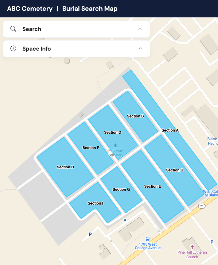
Digital Cemetery Mapping Software

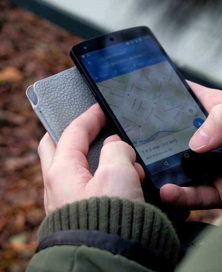
Transform your cemetery with GPS-enabled digital mapping and easy-to-use public access apps.

Say goodbye to paper maps and hello to interactive, mobile-friendly digital cemetery mapping. Our digital mapping software provides everything you need from GPS precision to public access for families.

digital cemetery mapping software

What is Digital Cemetery Mapping?

Digital cemetery mapping transforms traditional paper maps into interactive, GPS-enabled digital platforms that work from any device, anywhere.

GPS Precision

Every plot is georeferenced with GPS coordinates for exact location accuracy within 3 feet.

Mobile Accessible

Works perfectly on smartphones, tablets, and computers for on-the-go cemetery management.

Public Access

Enable families to find burial locations independently with optional public mapping features.

Complete Digital Mapping Features

Everything you need for professional cemetery mapping and management in one integrated platform.

Cemetery Interactive mapping

Interactive digital cemetery maps with GPS precision.

Click any plot to view detailed information including owner and burial records. Navigate your cemetery like Google Maps with zoom, pan, and search functionality.

  • Click plots for instant burial and ownership details.
  • Color-coded availability status (available, sold, interred).
  • Zoom from overview to individual plot level detail.
interactive digital cemetery mapping
GPS navigation to cemetery plots
Cemetery GPS navigation

GPS navigation & turn-by-turn directions.

Guide visitors directly to grave sites with precise GPS coordinates and mobile-optimized navigation. Include printable maps for offline use.

  • Walk-to-site GPS directions from parking areas.
  • Printable maps for offline navigation.
  • Google Maps support.
Public Cemetery Search

Public burial search for families & visitors.

Let families find their loved ones independently with customizable public access. Control what information is visible while providing 24/7 self-service capabilities.

  • Customizable public access apps.
  • Family-friendly search by name or date.
  • 24/7 availability reduces office calls.
public cemetery access portal

Digital vs. Paper Cemetery Mapping

See why cemeteries are making the switch from paper maps to digital solutions.

Feature Paper Maps Digital Cemetery Mapping
Accuracy
Often outdated or unclear
GPS-precise locations
Accessibility
Limited to office hours
24/7 access from any device
Search Capability
Manual searching only
Instant search by name, date, plot
Weather Resistance
Damaged by weather
Always available, cloud-stored
Family Access
Must visit office
Self-service online access
Updates
Expensive to reprint
Real-time updates included

Ready to digitize your maps?

Sign up today and see how easy it is to manage your cemetery with GPS precision and public access.

Sign up today